They say that journalism is the first draft of history. One can see a flaw behind that reality in the case of the flooding of the mountain town of Wrightwood this December. The news media is all over the latest disaster, with telling pictures:
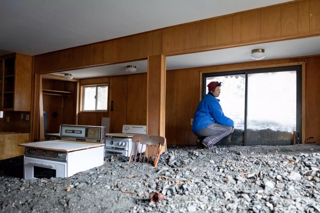
That’s from a solid LA Times story about what just happened, published on Christmas. But it overlooks an underlying reality.
It so happens a geologist wrote up an analysis of Wrightwood, geologically and topographically, years ago. Turns out to be no mystery why a debris flow came through the town in these December storms. Not only was Wrightwood built atop the San Andreas Fault, but the town is also downhill from a geologically famous natural hazard. It’s a huge deposit of a loose rock that has encourages mudflows in the area for at least the last five centuries, and is even visible from space!
A geologist and professor named Garry Hayes explains on his blog, called Geotripper.
Friday, December 26, 2025
Revisiting the Wrightwood Mudflows of Ages Past: That Slope Won’t Be a Problem Will It?
Like many others, I’ve been astonished by the storms of the last few days and the effects across all of California and the Pacific Northwest. It’s not quite over, and if you are in one of the danger zones, listen to the emergency workers. They know what they are doing.
I’ve been especially attentive to the stories coming out of Wrightwood in Southern California. It’s been a well-known trouble spot for many years. Back in 2013, I paid a visit and had a look at the geological conditions that have plagued the area. What follows was posted in March of 2013.
You learn something new everyday. At least I hope you do. I learned something astounding revealed by satellite imagery of the Mojave Desert.
We were headed home a week or two ago, and were taking a “short cut” along the San Andreas fault in Lone Pine Canyon and through the town of Wrightwood. That’s right, “through” the town. The village is built on top of the San Andreas! But that’s not what I learned. I’ve known of the close proximity of the fault and the town for years.
It had something to do with the town’s other famous natural hazard: the Wrightwood mudflow. There is a slope south of the town heading at an elevation of more than 8,000 feet composed of deeply weathered and crushed Pelona Schist. As can be seen in the picture below, the slope is so steep that trees and shrubs can’t gain a roothold, and failures are constant, especially during the spring snowmelt and during heavy rainstorms.
The Pelona schist formed in the accretionary wedge of the subduction zone that lay off the California coast during the Mesozoic Era, and as such may be similar to the Franciscan Complex farther to the north. It is an attractive muscovite mica quartz albite schist in hand samples, but it doesn’t do well on steep slopes.

We passed several channels that were clearly designed to send the flows through town without causing further damage.

In May of 1941, just over a million cubic yards of mud and boulders flowed down Heath Canyon and into the town of Wrightwood, damaging and burying a number of structures. No deaths or injuries were reported. The immediate cause was the rapid melting and runoff of the heavy snowpack during a period of unseasonably warm temperatures. Surges of mud continued for a week. Other damaging mudflows occurred in 1969 and 2004. [for more, see Hayes’ post].
Blogging is an almost-lost media art, but still can be hugely informative.
