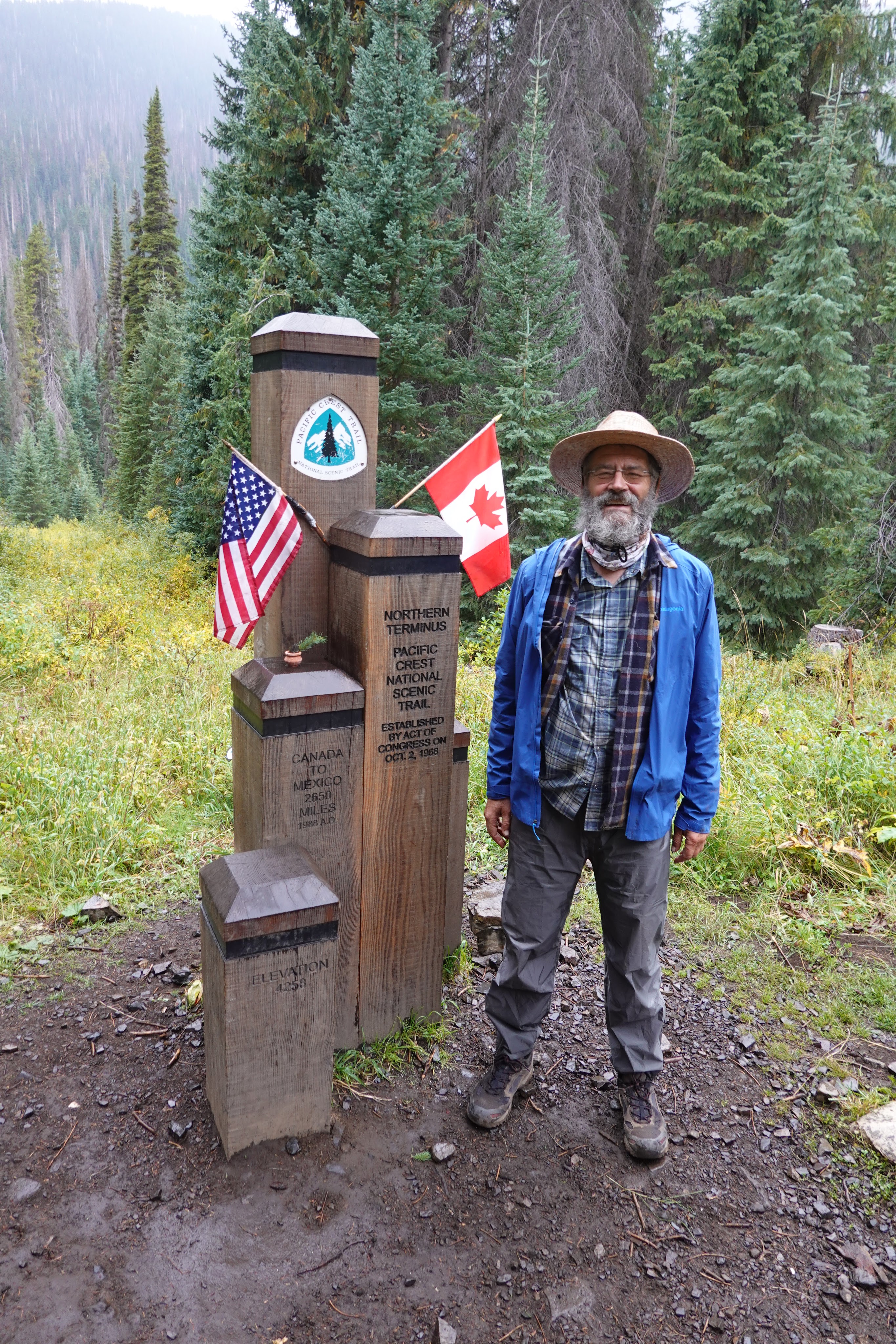
from the last seventy miles of the Pacific Crest Trail, completed this September after eight years of section hiking from the Southern Terminusfrom the top of Cutthroat Pass, where Chris and I took a break — about eight miles from our start at Rainy Pass
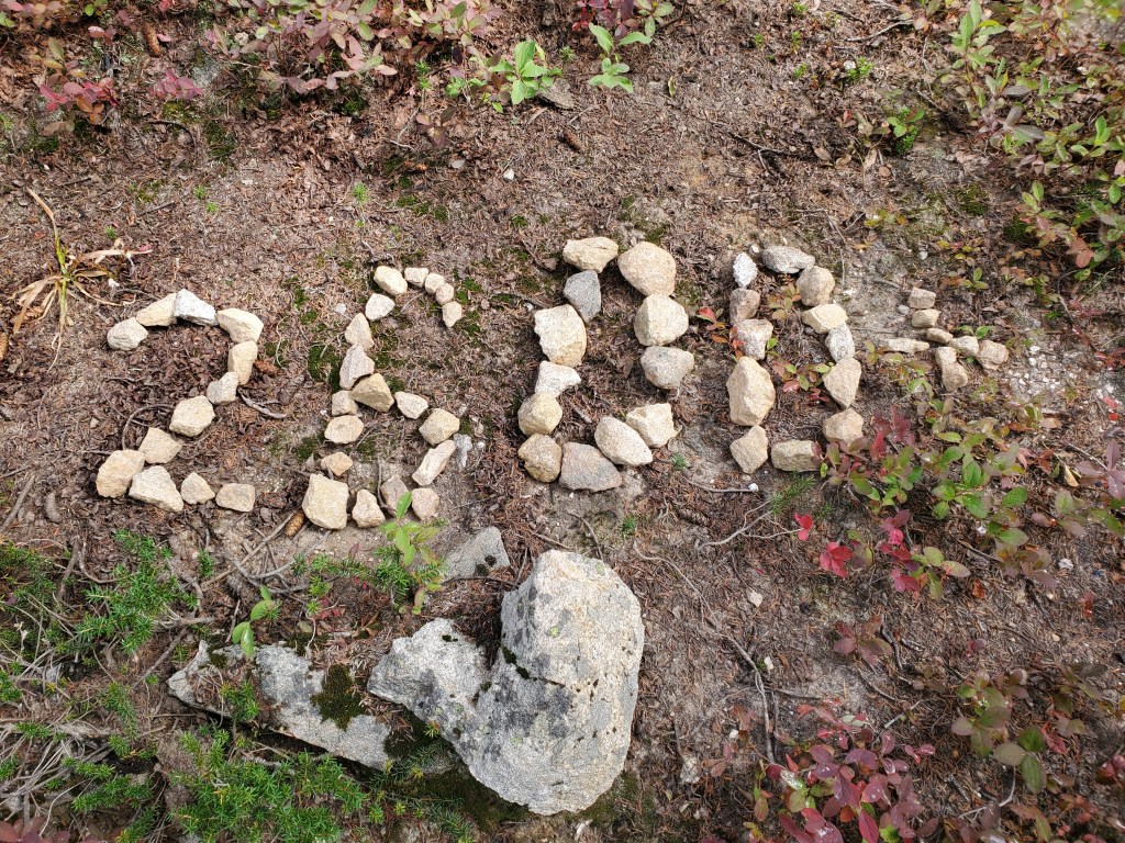
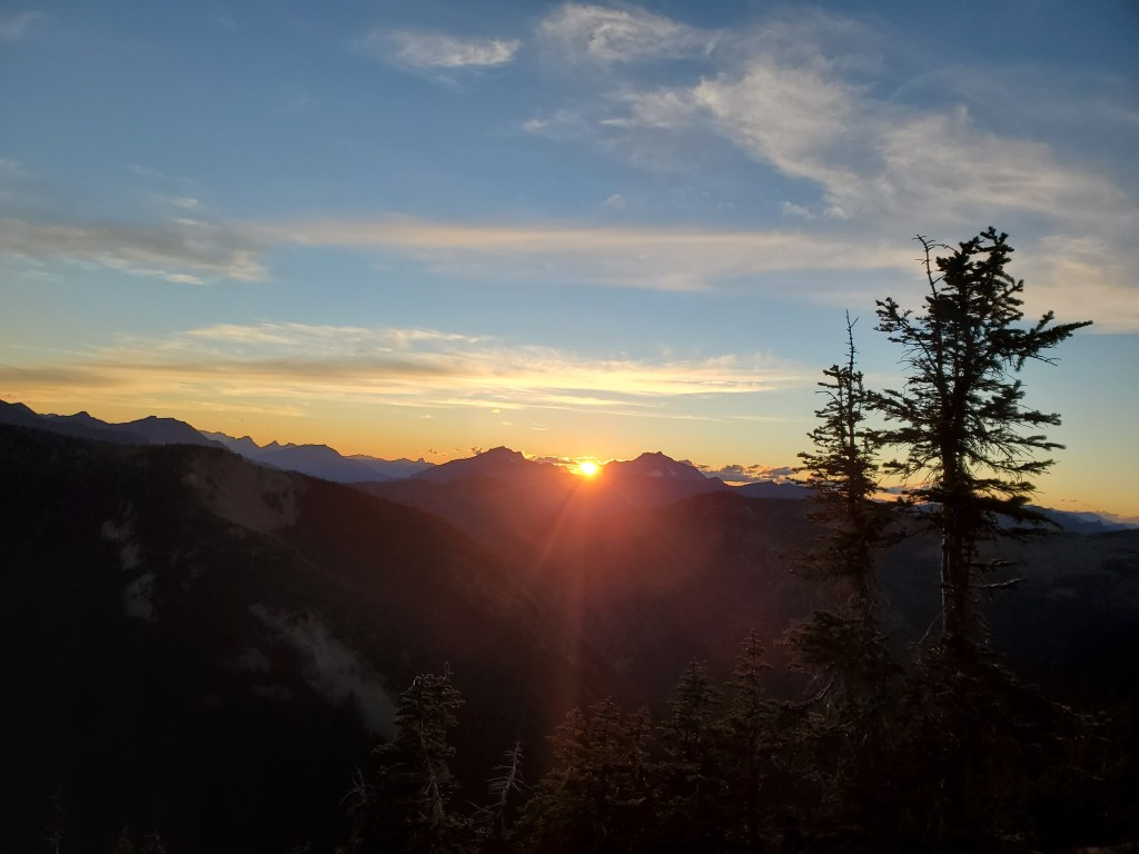
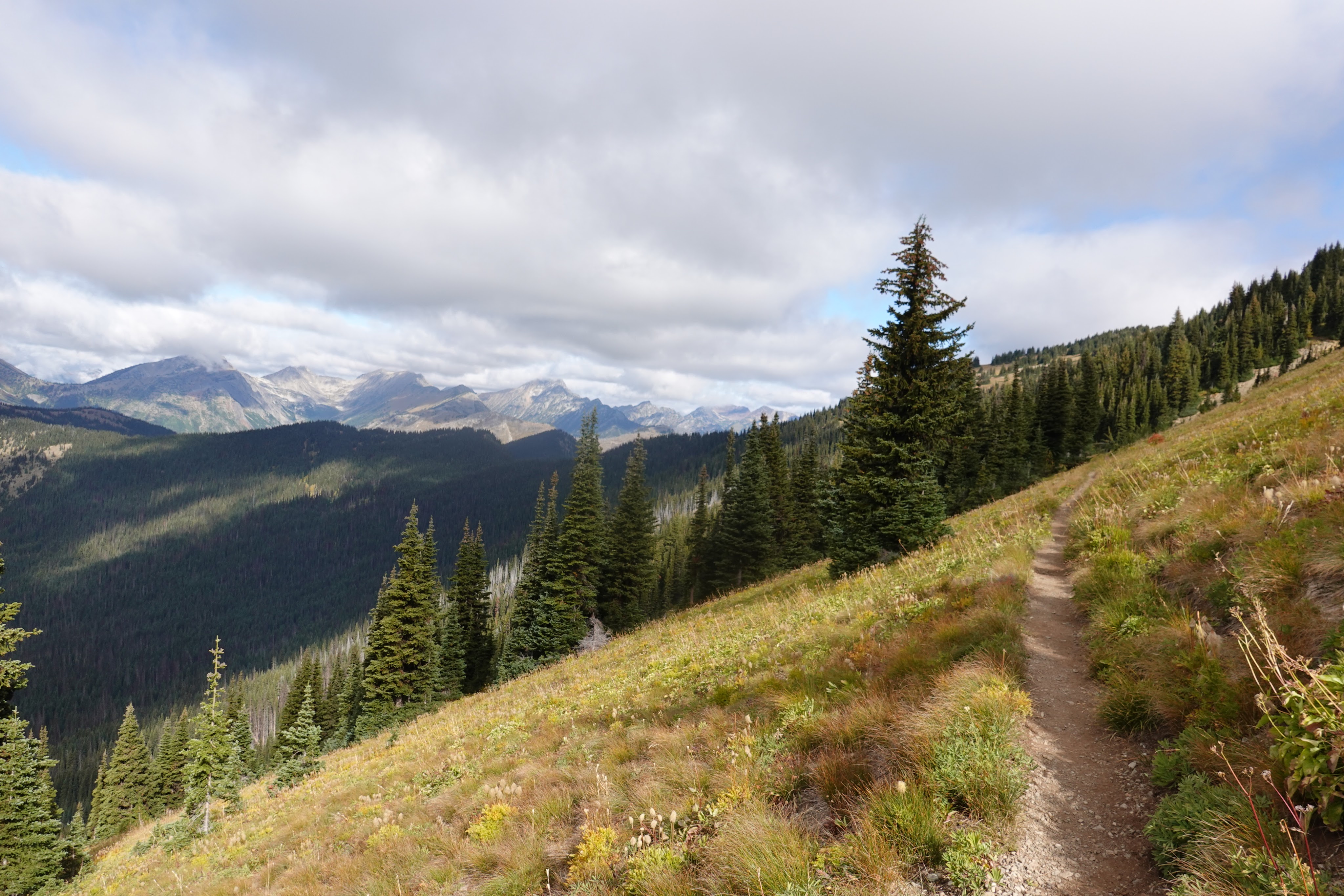
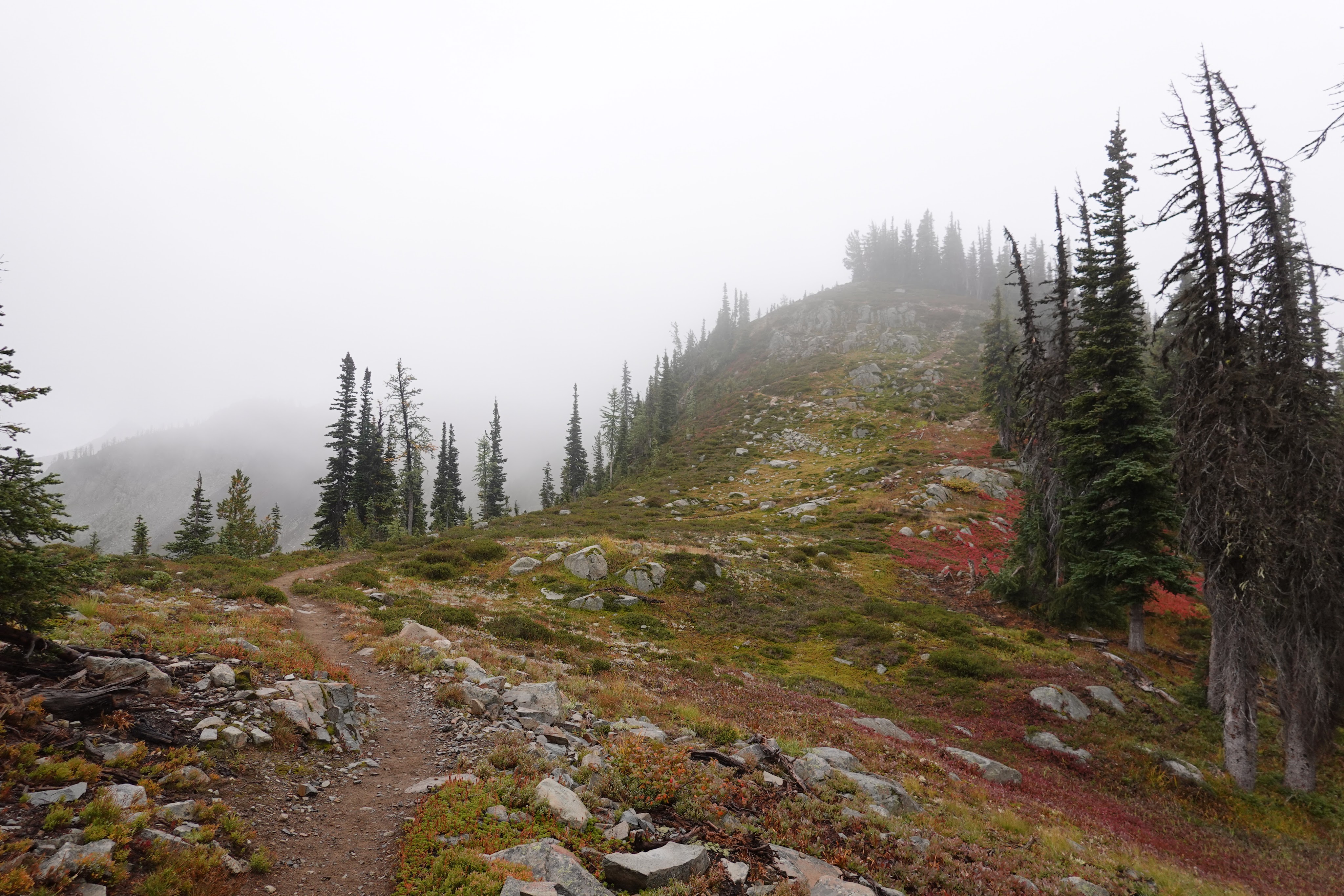
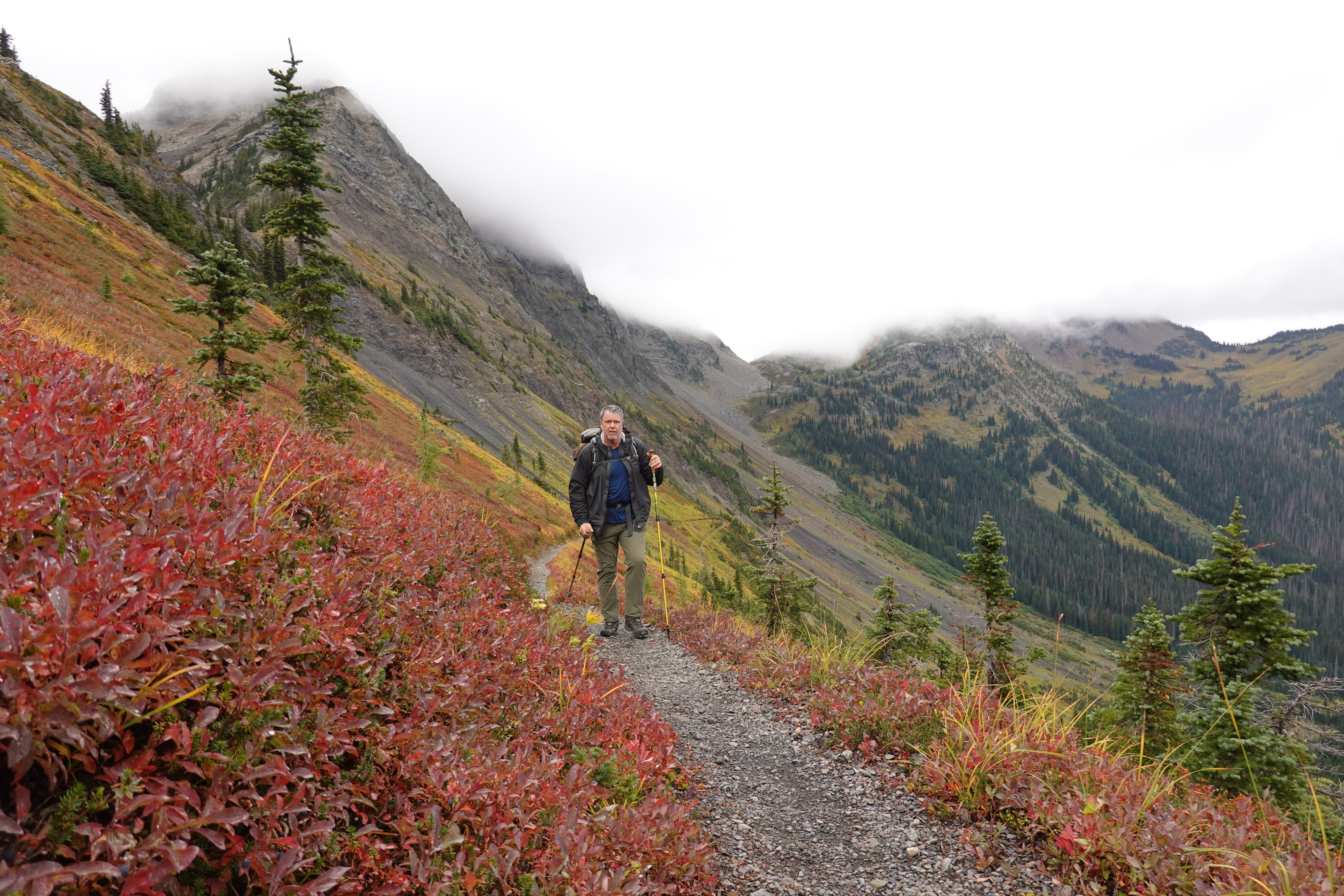
a marker indicating the length of the trail to that point,on the long descent from Methow Pass to Brush Creekthe Methow (pronounced Mett-tau) Riverfrom the climb from Brush Creek to Hart’s Pass — this is where I and a hiking buddy named Triple Pepper were knocked off the trail two years ago by a blizzard, and where I strained a calf muscle on this trip in September 2021 — but kept going It’s a challenging pass, reaching to 7000 feet, but very beautiful, especially at the top we camped just a couple of miles beyond Harts Pass, on a ridge looking west to the sunseton the next morning, we were into the high mountains — but too far away (about twenty-five miles) to see into CanadaRock Pass, where we camped on the fourth night in a cloud the last thirty miles — over Rock Pass, Woody Pass, Cloudy Pass — feature lots of up and down, lots of clouds, and beauty, beauty, beautyfrom the highest point on the trail in Washington state, Lakeview Ridge, at 7146 elevationThis is Hopkins Lake, almost exactly six miles from the US-Canada border. We put up tents here and left our packs and carrying just raingear, water, and snacks, hustled down to the border — as the skies darkened, bringing first a light but persistent rain, and then darkthe moment felt too big — what does one do at arrival after eight years of walking without expectation?after a rainy night, time to walk back home (to Harts Pass). This steep stretch on the hill is known as the Devil’s Staircase. This is the northern side of Woody Pass, if memory serves. Friend Chris Nottoli on the trail up to Rock Pass — sure glad we didn’t have snow on this stretchthe meadow on the descent from Rock Pass was something special — miles and miles of wildflowers (past their season, but still)Because of covid, we couldn’t exit through Canada, and had (with other thru hikers) to turn around and walk thirty miles back to Harts Pass. This turned out to be a good deal, because we met many wonderful and charming hikers, such as Shake and Captain Obvious here, who met on the Appalachian Trail, and here were just a day or so away from the end of the PCT. (Because my calf/ankle was hurting pretty bad, for the last five miles I took a side road, that to my surprise took my through a mostly-but-not-completely abandoned mining town, named Barron, where Roy had the sense to call ahead to the ranger’s office, and pass on a message to my buddy Chris, to pick me up at a locked gate on the road at the bottom of the hill (beyond the mining claims). This (below) is Roy. My rescuer. If he hadn’t radioed a message, Chris would likely have missed me, and it might have been another day to Hart’s Pass.looking north from the Pasayten Wildernessahhhhhhhhhhhhhhhhhhh
Fantastic trek Kit, and great works of art.
Ansel Adams 1902-1984 is in line up there to buy your work, right behind John Muir himself
How much $$ for the sign post ? lol
All the best
Dan


CONGRATULATIONS!!!!!!
I was wondering when you were going to finish. Such an accomplishment!!!!!
cheers, David
>
LikeLike
Congratulations! You asked, “What next?”
There is always another trail.
LikeLike
WOW, YOU DID IT Wonderful accomplishment.
LikeLike
thanks all — now to find another worthy trail —
LikeLike
Impressive feat! Congratulations Kit. How about taking on the trails of Cornwall as your next adventure? Lots of good pubs on the way.
LikeLike
Congratulations–that’s a long haul! Thanks for sharing these beautiful photos–lots of really good ones in there. Looking more Muir-like every day…
Brad
LikeLike
Fantastic trek Kit, and great works of art.
Ansel Adams 1902-1984 is in line up there to buy your work, right behind John Muir himself
How much $$ for the sign post ? lol
All the best
Dan
LikeLike