“We’re living in the future”: rainfall variability

The Ojai Valley News encouraged me while at a scientific conference in San Francisco last December to pursue a story about rainfall variability in Ojai and Southern California: here it begins.

“Last month was one of the driest Februaries ever in the recorded history of Southern California, according to the National Weather Service, with one-tenth of one inch of rain recorded for the entire month at the weather station in Ojai.”

Because all but that first sentence is behind a paywall that will exclude most of my readers, let me take the liberty of posting this story — an important one I think — and images in this post. Here it begins:

OJAI RAINFALL TURNS EXTREME — AND DRY

Last month was one of the driest Februaries ever in the recorded history of Southern California, according to the National Weather Service, with one-tenth of one inch of rain recorded for the entire month at the weather station in Ojai.

 
A vast ridge of high pressure across the breadth of the northern Pacific last month blocked storms systems from the north from reaching California. For the first time since 1864, no rain in February at all was recorded in the city of San Francisco. 

Because February is usually the wettest time of the year, that means chances of locations such as Ojai in Southern California recording an average amount of rain this year has fallen to about 10%, according to projections compiled by hydrologist Mike Dettinger of UC San Diego and the Scripps Institute of Oceanography. 

The plunge from a rainy December to a dry January, followed by a parched February, fits a pattern of extreme highs and lows that has been developing over the past sixty years,  according to research into tree ring records from the University of Arizona that included tree ring research from the Pine Mountain area north of Ojai. 

“These reconstructions [of annual rainfall using tree ring records] show that the recent increase in precipitation variability is unprecedented over the past 430 years,” wrote hydrologist Diana Zamora-Reyes in the abstract for her work presented at a scientific conference in December in San Francisco. 

Diana Zamora-Reyes presented her tree ring research at the AGU conference in San Francisco.

“Water resources managers will need to incorporate this increased volatility into their planning for public and agricultural water supply, while being aware of the higher risks for wildfires and floods,” she added. 
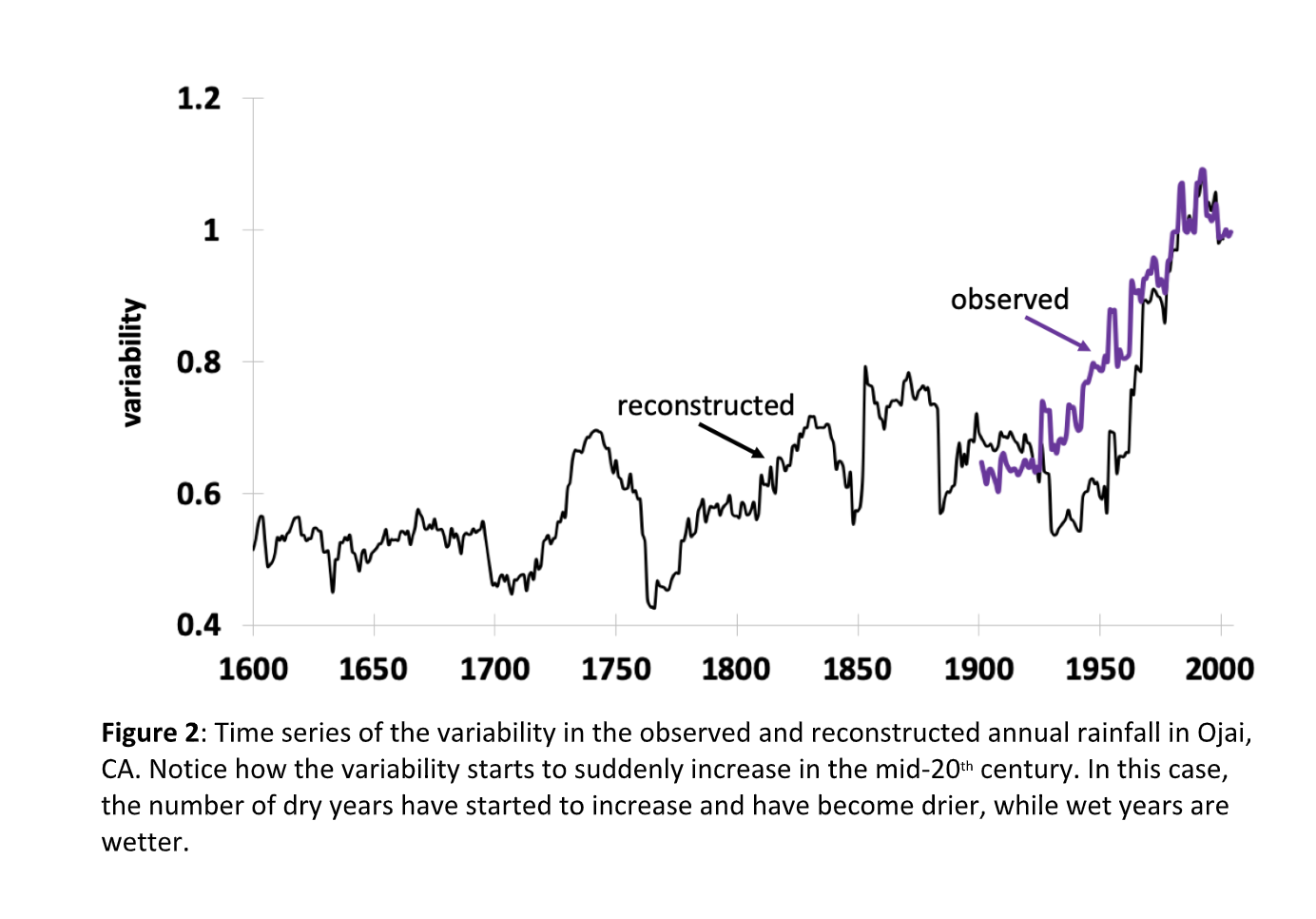

This research did not surprise water managers at Casitas Municipal Water District, given the severe drought suffered in the Ojai watershed from 2012-2016. “‘We had a major spike in drought this decade,” said General Manager Michael Flood. “Basically we did not have a whole lot of rainfall until this last year.” 

Zamora-Reyes’ research incorporated other research from the University of Arizona’s well-known Laboratory of Tree-Ring Research, which was funded in part by the California Department of Water Resources (DWR). Dave Meko, another researcher at the lab, said that big cone Douglas Firs in the Mt Pinos region provide especially good records of droughts dating back to the 1580’s. 

“In Southern California, a number of the reconstructions indicate that the 2012-2016 drought was the worst 5-year drought in the past six centuries, as measured by the percent of average annual precipitation or streamflow,” he wrote in a study prepared for the DWR at the end of 2017. 

Scott Holder, a hydrologist with the Ventura County Watershed Protection District, pointed out that his district’s own records show the same volatility in precipitation in recent decades.

“The data we have, which dates back to a little before 1900, show that we have had the wettest years and the driest years in our record in the last twenty years or so,,” he said. “Our wettest year [in the Ojai region] was 1998, with 49.23 inches of rainfall, but our driest year was 2007, with just 7.43 inches. 2013 was the sixth-driest year on record, and 2014 was the seventh-driest year on record, but 2005 was the fifth-wettest year on record.” 

Holder said that climate change is believed to play a role in the swing towards extremes in precipitation in Southern and Central California. 

“There’s no conclusive evidence, but there’s a strong indication that climate change is at least somewhat responsible,” he said, adding that the amount of rainfall in Ojai to date this water year — about eight inches — says little about the total amount of rain to expect this year. 

That point was echoed by members of the Board of Directors at Casitas. 

“I was born in the Oxnard plain hundreds of years ago and if I’ve learned anything it’s that you can’t predict the rest of the year based on the rain you’ve received by January,” said Angelo Spandrio. “I don’t think that what we’ve seen so far is any indicator. We could have beautiful spring rains and we could get nothing. I’ve seen both.” 

Michael Flood, the general manager, said that the district is preparing a new comprehensive water resources plan, incorporating the 2012-2016 drought, to be released probably at the end of this quarter. He said that the plan recognizes climate change as a factor to be incorporated in planning.

Russ Baggerly, who serves on the board of directors at Casitas and at the Ojai Basin Groundwater Management Agency, stressed the uncertainty water managers face. 

“I’ve been to many seminars where scientists were talking about climate change,” he said. “The question is how things are going to change for us, and the answer is: nobody knows. The ultimate statement I took away from these presentations is that “Stationarity Is Dead,” meaning that we can’t rely on the weather repeating itself in some sort of past predictable fashion. Nobody knows what climate change will bring us. Some say that the rainy periods will be stronger and more violent, and some say they will be followed by droughts and wildfires that plague us forever.” 

Daniel Swain, a leading research climatologist, said that climate modeling shows an increasing tendency towards divergent extremes of both wet and dry in Southern California. Though the total amount of rainfall is not expected to change substantially, it is expected to come increasingly often in bursts of hard rain. 

“We’re living in the future now,” he said. “In California we do expect to see more dry days, and more dry days even in the wet season. We also have a projected increase in the wettest of wet days, but right now we’re seeing increased aridification during dry periods, and a later onset of the rainy season.”  

a change in the wind: Australia edition

What the approach of a firestorm looks like from the ground. 128 seconds long: watch it once and you will never forget it.

Going to Extremes in 2020

Is it a coincidence that as the climate in which we live is thrown out of balance — becoming increasingly unpredictable and extreme — that by freakishly bad luck we happen to elect the most unpredictable and extreme president in memory?

This is what dystopia really looks like to me: a government completely unable to face up to an existential crisis. The fires, the floods, the climate chaos: that’s window-dressing, strange as it might be to say. What if we chose this fate, for some twisted reason? The fact that the Trump administration is in fact throwing fuel on the flames of a “perturbed” climate adds to the dysfunction but doesn’t explain it.

Put simply: Is it possible that global heating is driving us all — Trump most definitely included — crazy?

Tom Toles seems to think so.

Climate suicide in Australia: Chernobyl for government?

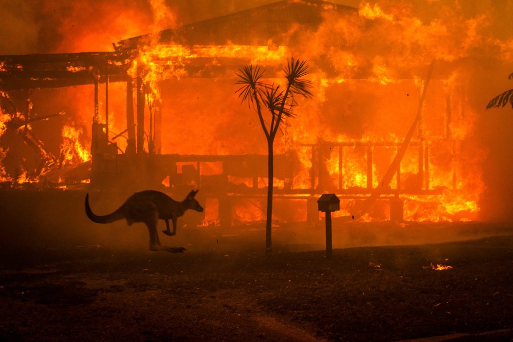
The horror of the bushfires enveloping the coasts of Australia brings very bad memories back to those of us who survived similar (I imagine) wildfires in Southern California. The orange skies — “blood red” in New South Wales — the vaporized houses, with the roofs flat on the ground, the animal carcasses, the grim expressions of friends and neighbors looking at the devastation.

In Australia, the novelist Richard Flanagan lays out the disaster in blunt, verifiable terms for an op-ed for the NYTimes:

BRUNY ISLAND, Australia — Australia today is ground zero for the climate catastrophe. Its glorious Great Barrier Reef is dying, its world-heritage rain forests are burning, its giant kelp forests have largely vanished, numerous towns have run out of water or are about to, and now the vast continent [about the size of the lower 48] is burning on a scale never before seen.

The images of the fires are a cross between “Mad Max” and “On the Beach”: thousands driven onto beaches in a dull orange haze, crowded tableaux of people and animals almost medieval in their strange muteness — half-Bruegel, half-Bosch, ringed by fire, survivors’ faces hidden behind masks and swimming goggles. Day turns to night as smoke extinguishes all light in the horrifying minutes before the red glow announces the imminence of the inferno. Flames leaping 200 feet into the air. Fire tornadoes. Terrified children at the helm of dinghies, piloting away from the flames, refugees in their own country.

The fires have already burned about 14.5 million acres — an area almost as large as West Virginia, more than triple the area destroyed by the 2018 fires in California and six times the size of the 2019 fires in Amazonia. Canberra’s air on New Year’s Day was the most polluted in the world partly because of a plume of fire smoke as wide as Europe.

Scientists estimate that close to half a billion native animals have been killed and fear that some species of animals and plants may have been wiped out completely. Surviving animals are abandoning their young in what is described as mass “starvation events.” At least 18 people are dead and grave fears are held about many more.

https://www.nytimes.com/2020/01/03/opinion/australia-fires-climate-change.html

But Flanagan also details how the right-wing government, backed by an unholy alliance of Murdoch media and a coal baron, has suppressed reasonable attempts to reduce emissions and prepare for these inevitable disasters, mostly by not allowing discussion of global heating. This is leading to bitter resentment when Morrison visits towns leveled by fire.

To wit:

On Thursday, Mr. Morrison was heckled as he visited Cobargo, a New South Wales village where fires have killed two men and destroyed the main street. When he extended his hand to one woman, she said she would shake it only if he increased spending on firefighting.

“You won’t be getting any votes down here, buddy,” one man yelled. “You’re out, son.”

This was shown even in news footage, as a firefighter who just lost his house reacts to a visit from the Prime Minister.

https://platform.twitter.com/widgets.js

Flanagan points out that the Soviet Union collapsed after the Chernobyl disaster, in large part because the people lost all faith in the government.

Mr. Morrison may have a massive propaganda machine in the Murdoch press and no opposition, but his moral authority is bleeding away by the hour. On Thursday, after walking away from a woman asking for help, he was forced to flee the angry, heckling residents of a burned-out town. A local conservative politician described his own leader’s humiliation as “the welcome he probably deserved.”

As Mikhail Gorbachev, the last Soviet leader, once observed, the collapse of the Soviet Union began with the nuclear disaster at Chernobyl in 1986. In the wake of that catastrophe, “the system as we knew it became untenable,” he wrote in 2006. Could it be that the immense, still-unfolding tragedy of the Australian fires may yet prove to be the Chernobyl of climate crisis?

Walking around Mt Tam

One of the most beautiful and least known poetical flowerings of that outpouring of youth and art we call the 60’s was, arguably, a journey on foot around Mt Tamalpais, in Marin County north of San Francisco. This honoring of “the quiescent one,” this circumambulation, a walk completely around the mountain, following with our feet the way of the sun, from bottom to top and back again, was a brilliantly ceremonial idea first tried by a Buddhist monk and two important poets from the 1960’s.

According to the history of this formalized journey — “Opening the Mountain,” by Matthew Davis — the walk grew out of the famed San Francisco demonstration in Golden Gate Park known as the “Human Be-in,” which apparently went extraordinarily well, and inspired those at the gathering to think of other new forms of socializing. Participants went on to events like Monterey Pop, the march against the war in Cambodia, and Woodstock.

But to me this relatively modest day-long journey on foot, from the redwoods of Muir Woods to the manzanita around Inspiration Point, from the soft loam of the deep forest to the rocky peak of the lookout tower and back again still stands as one of the purest and sweetest expressions of that mixed-up era. (When the book arrives I’ll quote and link to a poem Gary Snyder wrote for the occasion and I think you’ll see what I mean.)

At ten points on the mountain the original journeyers — Philip Whalen, Allen Ginsberg, and Gary Snyder — stopped to honor a place on the land. The first such example was a substantial lichen-speckled boulder split by a sturdy oak, draped with moss.

Tree Rock

My companion, I’m happy to say, was my indefatigable friend John Chiosso, who had the sense to bring the book. He wondered, reading the book before the walk, if we would recognize the first “glorious one.” Would a small tree growing out of a rock be easily visible? (It’s a reasonable question: some other notable sights on the trail — such as lone redwood on a ridge — have in fact vanished. The lone redwood is now lost in a forest of Douglas Firs.)

But Tree Rock was never in doubt: we saw it at a glance. I think all the sites in the book were recognizable to our eyes, and yes, even quieter sites — a mossy grove, perfect for lingering for tea, or dappled sun, or what have you — felt irresistible. We often (if not always) read the chants to these “glorious ones” along the way. We walked from dawn to dusk, and as the light rose we came up out of the dark woods near the sea to the hard rock and gnarled chaparral around the peak. Beauty surrounded us from start to finish, as varied and exuberant in its worldly way as a melody. John will testify so, if you don’t believe me.

Ventura County: heating up (Washington Post)

According to a superb reporting “project” from the Washington Post, Ventura County is the fastest heating county in the Continental U.S.

“Since 1895, the average temperature in Santa Barbara County has warmed by 2.3 degrees Celsius, according to The Post’s analysis. Neighboring Ventura County has heated up even more rapidly. With an average temperature increase of 2.6 degrees Celsius since preindustrial times, Ventura ranks as the fastest-warming county in the Lower 48 states.”

Damn, man.

Into the Red: Ventura County’s new climate

Today the Ventura County Reporter ran my story on a study looking at climate change in this area in the next twenty years. I hope to write a full story on climate action and the underlying question: how much is the county contributing to warming, and how much are we Ventura county residents doing to balance the scales?

Let me run the whole story, the second half below the fold:

photo of Thomas Fire from Kari Greer of the U.S. Forest Service

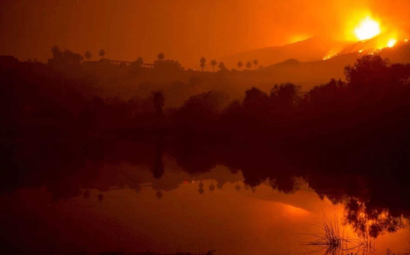
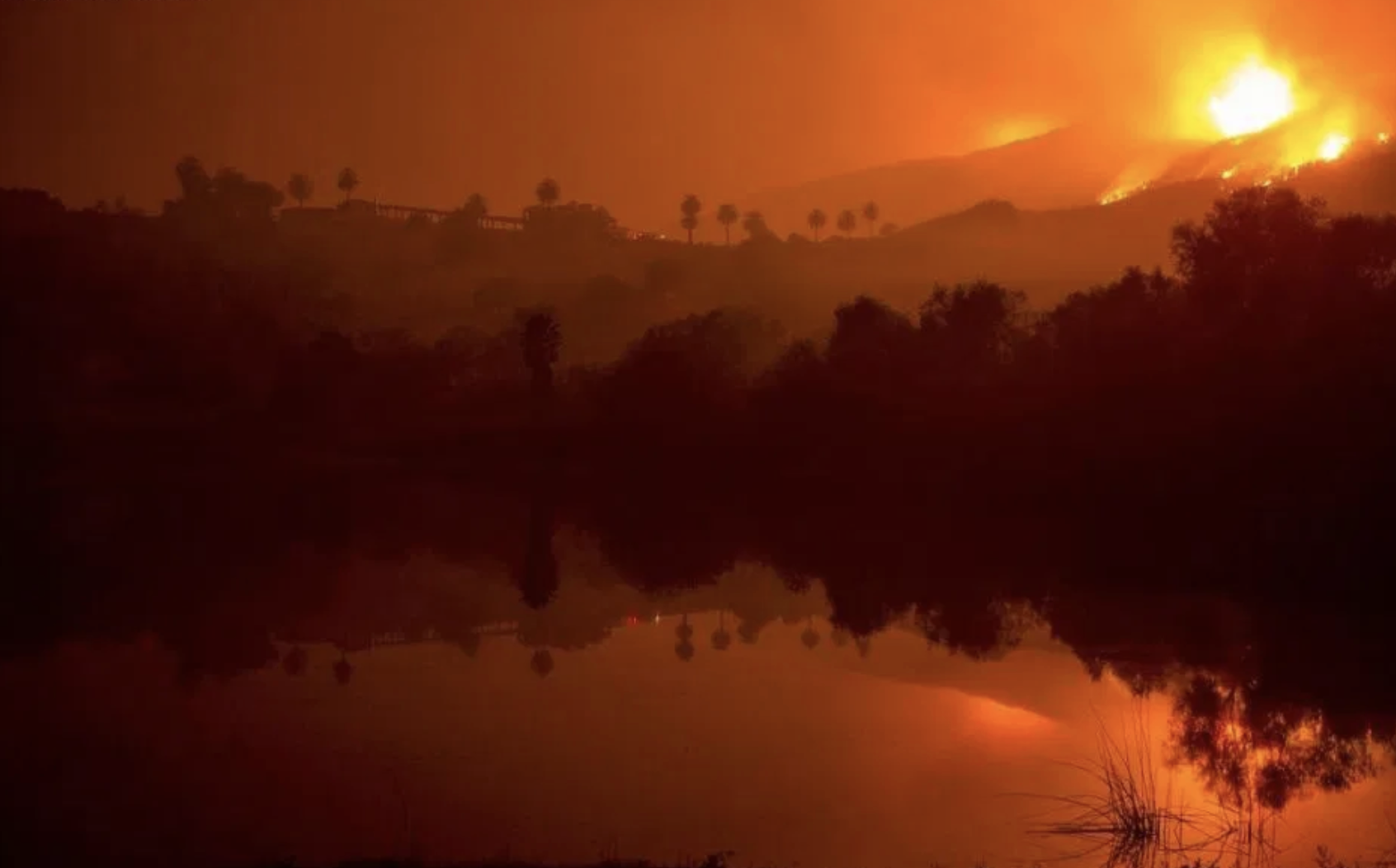
In 2017, during a record “red flag” wind event in December, the Thomas Fire burned from Santa Paula westward into Ventura and northward around Ojai into Santa Barbara County, killing one county resident and a firefighter, totaling over $2 billion in property damages and costing over $200 million to fight.

In November 2018, during a “red flag” wind event, the Woolsey Fire burned from the Santa Susanna Mountains above Simi Valley all the way to the ocean, killing three people in Malibu, destroying over 1,000 homes and forcing the evacuation of well over 200,000 people.

On Oct. 30 of this year, an “extreme red flag warning” wind event drove the Easy Fire from the Simi Valley mountains toward the Ronald Reagan Library. Two days later, high winds drove the Maria Fire from an overlooking ridge down toward Santa Paula, Somis and Saticoy.

Ventura County’s climate is changing. To better understand what it will look like in the near future, two researchers for the Desert Research Institute (DRI), under a grant administered by the Ojai Valley Land Conservancy in 2018 and using an ensemble of 32 climate models, projected our future climate for the years 2020-40.

What does our climate in Ventura County look like in the next 20 years?

The report, “Projected Changes in Ventura County Climate,” stresses that higher temperatures will heighten the risk of wildfire.

“Wildfire season will likely extend earlier into the spring and early summer and later into the fall and early winter,” states the executive summary, “due to drying in these seasons, increased temperature, and greater evaporative demand.”

The blue line shows average temperatures from December 2017 through November 2018. Note the spike in temperature for the month of December (when the Thomas Fire broke out) — 8 degrees above normal. Another spike in July 2018 coincides with the heat waves that led to avocado damage across the county. Source: California Climate Tracker, Desert Research Institute, Western Regional Climate Center

All of those conditions were on hand when the Thomas Fire broke out in December of 2017. Winds as fast as 60 mph were recorded in the local mountains. Because the county had seen below-average rainfall for most of the decade, levels of fuel moisture in hillside plants were extremely low — less than 10 percent. The average temperature in the county was nearly 8 degrees above normal for the entire month of December [See graphic, “South Coast (Climate Region)”]

“Already our wildfire season extends earlier in the spring and later into the fall,” said Mark Jackson, meteorologist in charge of the National Weather Service office in Oxnard. “There’s a domino effect that happens with longer fire seasons.” As moisture is transpired by plants out of the soil, he explained, the ability of the land to cool lessens, amplifying the heating.

For Devon Davis, an amateur meteorologist based in Camarillo who mans the @805weather Twitter feed focused on Ventura County, the first result that stood out from the DRI study was “an increase in drying winds associated with Santa Ana wind events.” He noted the Thomas Fire as an example of such a wind-driven fire.

“The fact is that now there’s an increased likelihood of wind-driven wildfires,” he said. “The study is kind of a real-time look into the near future.”

Continue reading “Into the Red: Ventura County’s new climate”

Calinfernia

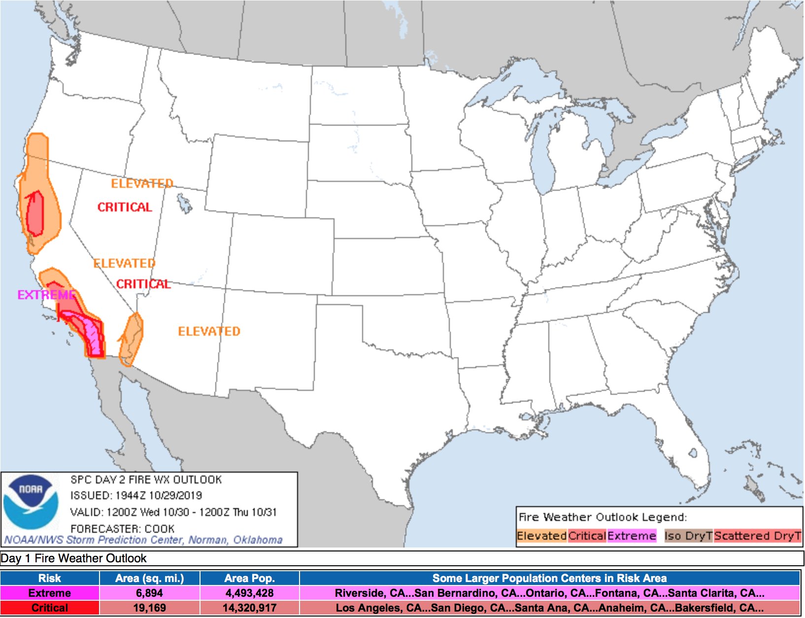
Here in Ventura County, an “extreme” red flag warning wind event is expected to arrive in a few hours.


Southern California Edison has already all but promised to turn out the power for essentially all of northwestern Ventura County, from Piru to Casitas Springs, as shown in this map in the bluish-gray areas. Friday could easily be out until Friday.


More to be said about this than can possibly be said in a quick post, but let me tip my cap to Jack Ohman’s ‘toon on the subject of California burning today in the Sacramento Bee.